This page uses javascript to help render elements, if you have problems please enable javascript.
 
You are now inside the main content area


left col

OCDAP Home
Licensing & NDA
Documents & Products
Members
Contacts

Note: The OCDAP is not a CDR-specific project but the website is maintained by CDR.

ORANGE COUNTY DATA ACQUISITION PARTNERSHIP (OCDAP)

The Orange County Data Acquisition Partnership (OCDAP) is a collaborative data acquisition program for digital aerial imagery and other electronic geographic data focusing mainly on Orange County, California.

Project Objectives:

  1. Obtain high accuracy aerial imagery (and related products) to support local agencies’ needs, such as land use and asset monitoring, pre-engineering design, and geospatial analyses.
  2. Unify imagery acquisition to improve communication among Orange County and regional agencies.
  3. Eliminate duplicate imagery acquisitions for many agencies and leverage economies of scale to obtain more and better products.
  4. Save taxpayer money and increase efficiency through collaboration. 
  5. Integrate aerial imagery and related products with the participant land use databases and other geographic information system (GIS) layers.

OCDAP Cycle 3- Sign up now for summer 2026 imagery

Agencies interested in the summer 2026 aerial imagery should sign and return the Cycle 3 Participation Agreement following the instructions included within the PDF. For questions, visit the Contacts page.


OCDAP 3 DELIVERABLES

Orthogonal Imagery

  • 4-band orthogonal imagery (including color infrared) at 3-inch or higher resolution in both urban areas, and the National Forest.
  • Multiple formats (TIFF, JPEG2000, and compressed ECW).

Oblique Imagery

  • 3-band color oblique imagery at 4-inch resolution.
  • Online hosted access for desktop and mobile devices.
right col


left col

CONNECTExplorer

CONNECTExplorer                   

Web-based application that accesses imagery stored in the cloud

Launch Need Login?

CONNECTMobile

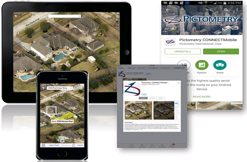
CONNECTMobile                 

Lightweight mobile version of CONNECTExplorer available on iOS or Android devices
Details

ArcGISDesktop

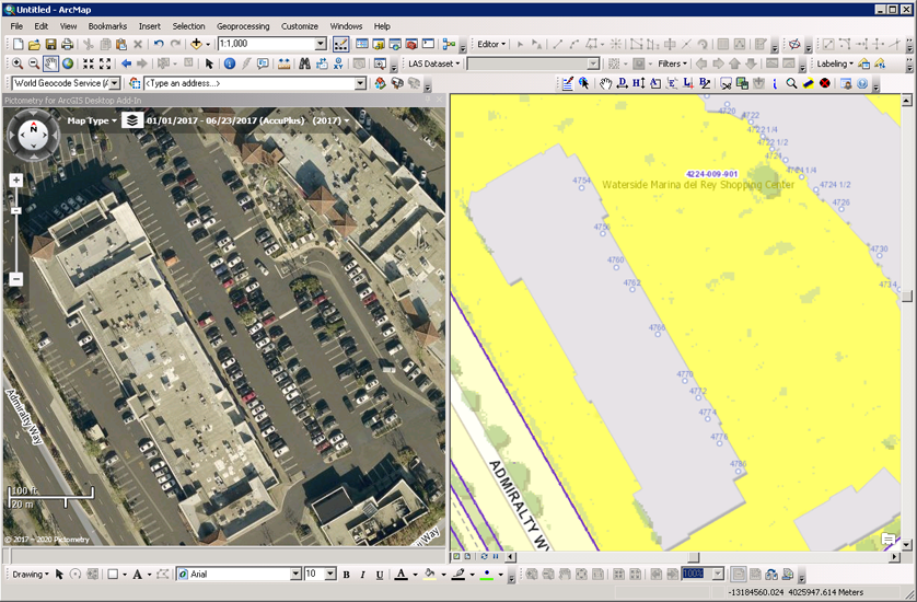
ArcGIS Desktop and ArcPro Plug-ins

Gives access to oblique imagery and measurement tools without having to leave application

Desktop Pro

right col
 
 
left col


EagleView CONNECT Video Library how-to instructional videos: https://www.eagleview.com/resource/connect/ 


For more information regarding EagleView product integration into your applications, review the LARIAC powerpoint presentation or contact:


David Alexander
District Sales Manager, CA/AZ/NM/NV
Eagleview
[email protected]
(408) 838-2831


OCDAP Cycle 2 (FY2022/23-FY2023/24)

Cycle 2 has officially ended and the online service is no longer active. However, agencies wishing to obtain the local deliverables (2022 imagery and building footprints) should fill out the Cycle 2 Participation Agreement (with instructions) located under Documents & ProductsVisit the Contacts page for contact information.
 

OCDAP Cycle 1 (FY2020/21-FY2021/22)


right col